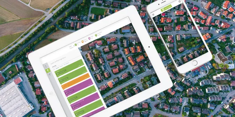
Take a minute to think about advertising in 2018. Where do you see the most ads? Likely, your first thought was an ad you saw online. Businesses have realized that if they want to reach their target market, they have to bring ads to their fingertips. People spend more time online than ever before. By using an interactive map for your project, community members are able to engage easily from their phone or computer instantly.
1. It’s easy to participate
Encouraging participation with projects is often one of the most essential but challenging steps to a planning project. Many community engagement plans often involve town meetings, polls or surveys in the mail, posters, or even setting up a table at the local shops to gain public insight. But what about those who choose not to engage with any of these methods? The following are three types of people that you may be missing through your engagement methods.
Busy Residents
Although you may receive a decent response through these methods, have you ever considered all of the people who haven’t participated because they simply don’t have the time to stop and chat or fill out a survey? Many people have plenty to do after their general work day ends. It’s important to understand that planning projects affect a much larger portion of the community than those who participate. Because these residents are affected, it’s likely that they would love to participate if they had more time. We live in a fast-paced world where we simply don’t have enough time in the day to get things done yet somehow we always find time to waste on our computer or phone. With this in mind, let’s bring engagement to them. An interactive map makes it easy for these busy residents to participate because they can do it quickly and easily from their phone.
Millennials
The innovators of our future. This sector of residents are likely to join in where they see their peers participating. They generally spend a lot of time on social media which we need to use to our benefit. Millennials often share their opinions through social media because that’s where they interact with peers the most. Let’s use this to our advantage and reach them through the online platforms that they are accustomed to. Millennials often have strong opinions that are beneficial in shaping plans for the future. With an interactive map, they will be able to engage with community projects right from their phone where they prefer to spend so much of their time.
The Cynics
According to the 2017 Edelman Trust Barometer, government is distrusted in 75% of countries. These members of the public are generally less active when it comes to community engagement. It’s likely that they don’t believe that their opinions will be considered at all by local governments. With interactive mapping, these members of the community will feel that their opinion matters because their comments are up for the rest of the community to see.
Online engagement software can be overwhelmingly easy to use, and encourages participation from members of the community that are often unreachable.
2. Encourage Open Communication & Follow up
People want to know exactly what they are contributing to. There are always members of a community who are skeptical about engaging in public outreach campaigns for many reasons. Residents are more likely to feel connected to their community if local government is open with current projects. The problem with this is that most residents don’t have the time, energy, or desire to read a long project proposal. By using an interactive maps, the City of Newcastle has been able to share information about their projects in various areas of the city in their After Dark Strategy project.
Their interactive maps in Phase 1 and Phase 2 have received overwhelming response rates including comments, ideas, and discussions from residents to better understand how they can shape the plans to better suit the needs of the community.
Projects often have multiple phases with different community outreach needs. With interactive mapping, you have the ability to use separate maps for each phase. This gives you a chance to openly showcase the progress of a plan while ensuring the community that their engagement in important. In the example below you will see how the city of Maplewood, Minnesota used interactive mapping in two phases of planning for their comprehensive city plan.
Phase 1: Inform and Listen
This phase focused on gathering input from all segments of the community including what people like, what they have concerns about, where there are safety issues and what the comprehensive plan should consider. With interactive mapping, community members had the ability to drag and drop a pin on a map and leave a comment and/or discuss with other members of the community.
Phase 2: Consult and Collaborate
This phase focused on gathering more specific input and feedback on ideas and concepts, as well as goals, policies and actions on the draft plan. Interactive mapping allowed council to put potential concepts for the city plan on the map and allow community members to engage by liking or disliking, leaving feedback or discussing potential ideas.
The City of Maplewood realized that by including an interactive map each phase of their plan, they were able to build trust with community members and greatly improve engagement rates.
![]()
3. Welcome newbies to participate
Engaging online is something most people do every day, so let’s use this to our advantage. By creating a space for community members to leave their thoughts on a current planning project, they will feel empowered. It is common for newbies to feel out of place compared to others who have been active participants for a while but by giving them a space to contribute anonymously online, they will likely feel much more comfortable engaging. The interactive mapping software is a surprisingly fun tool for newcomers. Bringing community engagement to their fingertips will encourage more people than ever to explore community planning projects. It is essential for city councils to somehow create a connection with their community and with online engagement for a local project, community members will feel personally connected due to location familiarity.
4. Showcase plan & spread information
It’s often hard to spread information about your community development plan, transportation plan, environmental plan, or land use plan to the correct audience. While pubic participation is essential to tailoring these plans to fit the needs of a community, it’s often difficult to get a majority of the community to participate. An interactive map allows you to share a link within any online community and invite them to easily participate. These maps often include points on a map that council has set in place to provide information about the plan. Interactive maps have been used in all phases of a planning project whether it’s to initially gather ideas about what changes the community would like to see, share proposed ideas and gather comments on what the community likes and dislikes about the plan, or to simply share information about what all a plan will entail.
![]()
5. Reciprocity of respect between council and community
In order for a community and its stakeholders to want to engage with local government plans, they must feel that they will be respected. People often feel that if they were to contribute to public outreach campaigns, their insight isn’t actually considered. With an interactive map, local council is able to interact and discuss the planning project with the community openly which creates a sense of trust.
6. Save yourself time
Taking the time to go out and gather surveys, hold town meetings or table sessions at a local shop constantly puts stress on planners as they generally have an overload of work as it is. Creating a digital engagement space saves time for everyone involved and the easier it is to engage, the better your result will be. Rather than solely spending your time out begging for participation, you can share the online engagement space alongside your offline engagement strategies which often gets people excited. Even if they don’t intend to engage, it’s likely that they will still be interested in going to the space to learn about the project. Simply directing people to an interactive map of an area that affects them will be enough to spark interest. From there, they will likely find a piece of the project they are interested and engage.
7. Comments are generally thoughtful
Planners can often be scared away by the thought of an online platform for the community to share their thoughts. We have found that projects receive helpful and appropriate feedback. The best way to think about this is that if someone is taking the time out of their day to go onto the site it’s very likely that they are actually interested in the project and care about the outcome, therefore their comments are generally well thought-out and insightful.
8. Sharing Made Easy
With an integrated Social Media ‘share’ button on the map, it’s easy for users to share this to their own social media. The interactive map saves all of the data so it’s easy for council to leave their project’s map online for as long as they want to allow community members to go back and review. Online engagement is about creating an open space for stakeholders and community members to engage with a project, and making it easier to share the project and results only makes the map more interesting to those affected by a project.
9. Ability to use location based and stand-alone surveys
Imagine if you added up all of the time you’ve spent collecting surveys for all of your planning projects. Shocking, right? With online engagement, community members are able to participate in surveys from their computer or phone and with interactive mapping, you can actually place separate surveys on any point on the map that you choose. We have also released a feature of stand-alone surveys within your project on our engagement platform. We realize that surveys are an important part of community engagement and that’s exactly why we have made it so easy to incorporate them into any part of your interactive map.
10. Data is organized for you and is easily accessible
The online engagement software saves and organizes all of the data for you however you set it to sort. This will save you the time you’d usually spend sorting all of this data yourself. This interactive mapping software does all of the meticulous work for you and exports the data in a user friendly format for all of your planning needs.
11. You can use any type of map or image
It’s likely that most planning projects use their own sort of map. With the Social Pinpoint interactive mapping software, you can use virtually any sort of map you like or even a building design or computer-generated drawing. You can draw shapes onto your map as layers, or can upload your own map layer or GIS data. We also give you the ability to upload multiple map layers to allow you to create separate areas, steps, or aspects of your plan. With this flexibility, we are confident that we can find the right map to suit your planning needs.


